Original Publication DATE: 7/13/2011
Our adventure began in the heavy rain of late June. We waved farewell to Allison from the Canyon Creek Trailhead to walk the Bigfoot Trail–in search of wild plants and places–for two weeks. As we climbed into the Trinity Alps it was doubtful we would be able to hike very far because of heavy snow and high water. On our second day, as the rain cleared, we approached the dangerously swift Stuarts Fork and were, for a moment, stopped by Mountains and Water.
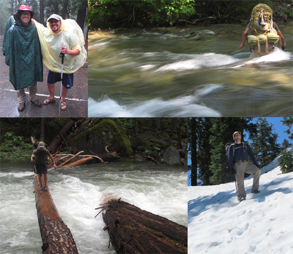
Luck was on our side. Eventually, the search for a crossing led us to a freshly downed Douglas-fir across the width of the raging creek. My brave hiking partner Jeffrey Kane tested the bridge without his pack and determined it was a go. As he walked across I followed with a crawl but regardless of form we were on the other side and the adventure could continue. High creek crossings and winter snow at the passes continued as we slowly walked sections 8-13 without further incident. After a week of summer weather with winter conditions we met our friend Radek at Seiad Valley and entered the Red Buttes Wilderness.
Into the Red Buttes Wilderness
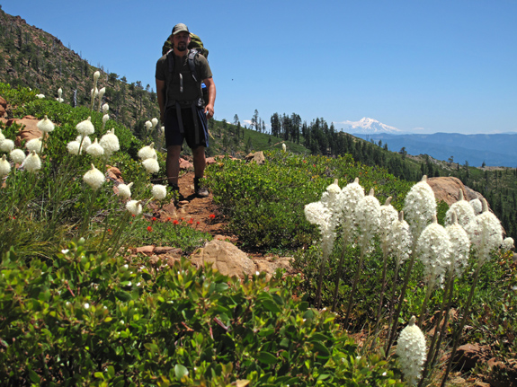
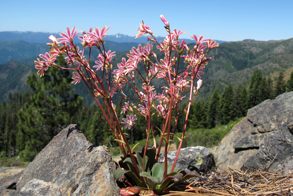
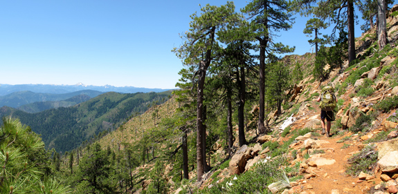
We had been seeing wildflowers and other signs of spring along the route to this point but the climb on the PCT along Devil’s Backbone into the high country of the Buttes offered the epic blooms and snow-free walking we had been dreaming about–summer was finally here! What follows is a photo-blog of some of the interesting observations we made in the Red Buttes–some inspired by the beauty of life others by the vectors of death. The forests of the dynamic Klamath Mountain region hold unparalleled beauty but are showing signs of a sickness facilitated by rapid climatic change. I am watching but can I help?
Yellow-cedar | Cupressus nootkatensis
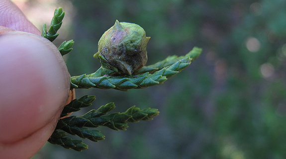
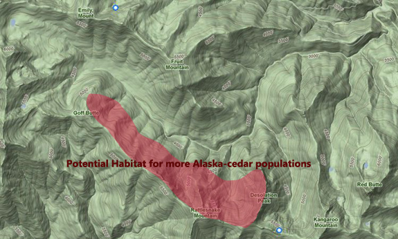
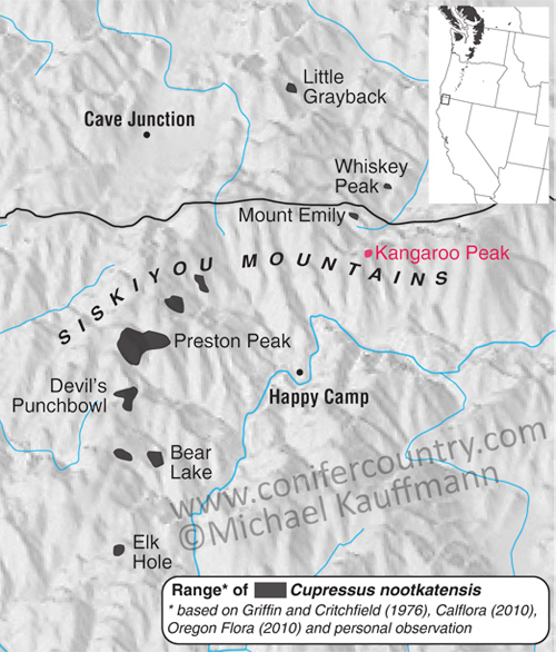
This tree is quickly becoming one of my favorite conifers in the region. Regionally, it is not very well understood nor easy to identify and can thus be easily confused with Port Orford-cedar (Chamaecyparis lawsoniana) and/or Siskiyou cypress (Cupressus bakeri). Because of its rarity the species has regularly been misidentified or overlooked. According to my data, there are now 9 distinct regional populations in California (see map below). It is most common around Preston Peak. Of those 9 populations I have personally documented 3–this is a 50% increase since 2006 when I first found a new population. Surely there are more out there. I also included a map below where more populations might be found in the Red Buttes. I also believe there are more to be found in the Siskiyou Wilderness.
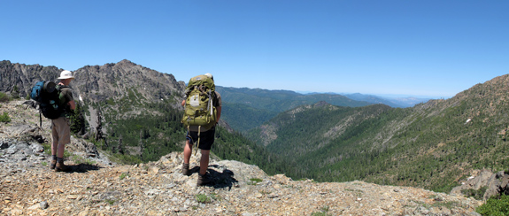
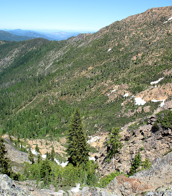 As we peered over the cliff face into the drainage below the yellow, weepy foliage caught my eye. I climbed down to find a small relict population of Alaska yellow-cedar thriving on the edge of serpentine in a cold and wet (for most of the year) pocket. I estimate the population to be less than 50 trees. This was a cone masting year and all trees that I saw appeared healthy. I hope to continue to monitor this population as it is an outlier in habitat from other Klamath populations–regionally this species is (and have been for millennia) harbingers for climate change.

western white pine | Pinus monticola
On specific sites across the western Klamath this species is dying fast. I have watched individuals become skeletons from one summer to the next. It is a complex and depressing issue. What follows is a discussion of the variety of factors that are leading to the decline of western white pine–particularly on serpentine substrates. Serpentine is already a fringe habitat for many species–but a habitat on which P. monticola has historically thrived. As climate warms and water disappears earlier in the season, more stress is placed on individuals allowing more and more factors to affect health. Western white pines are harbingers for forest health in these serpentine regions.
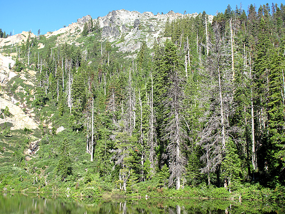
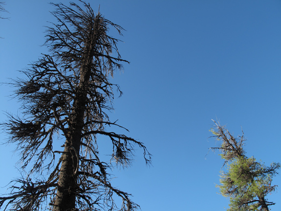
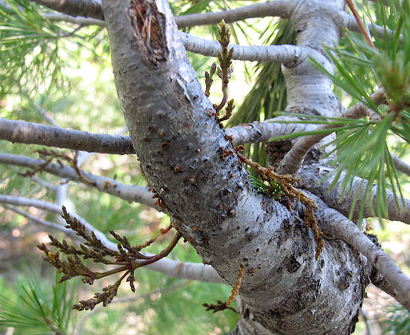
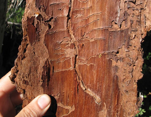
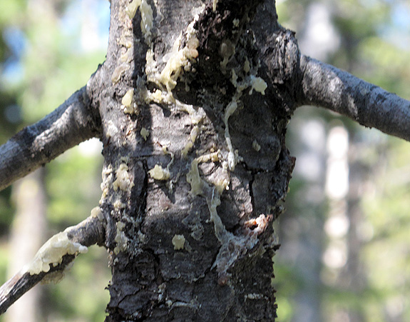
*Thanks to Jeffrey Kane to all he taught me about these forest pathology issues.
Klamath Fire regime
I’ll touch on fire regime briefly and leave you to ponder your next hike.
Fire is shifting forest dynamics across the West–particularly in the southwest where sky island forests are in dramatic decline because of frequent high intensity burns caused by a warming climate. Because of the temperate nature of the Klamath Mountains, forests have a better chance at recovery after a high intensity burn–at least that is what my novice, optimistic mind would like to believe. One burn we walked through–while on the Devil’s Backbone along the Pacific Crest Trail–was estimated by my Doctoral-Candidate-Fire-Expert-Friend to be about 25 years old. What we saw was high knobcone pine (Pinus attenuata) regeneration on south-slopes. We also witnessed forest pockets on north-facing slopes unaffected by the quarter century old burn–essentially seed-banks for future forest regeneration.
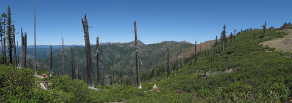
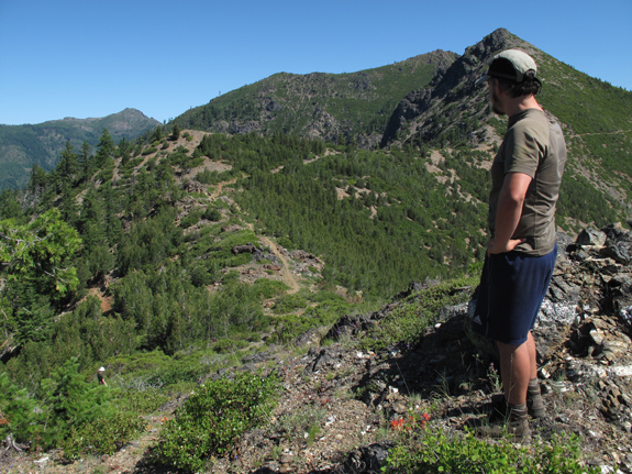
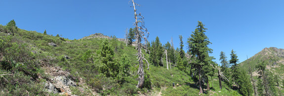
What was most remarkable to me was the recruitment of Brewer spruce (Picea breweriana) into fringe habitat that burned 25 years ago. These relict trees are not fire adapted–having thin bark and rarely growing near other trees (shade intolerant) where it would likely be subjected to the spread of fire. Instead, the survival regime of the Brewer spruce includes growing along lonely, exposed ridgelines where other trees won’t or can’t. The Brewer spruce we saw on the Devils Backbone were not acting like most–their efforts for existence included growing in fire prone areas as well as having the propensity to pioneer burned habitat. This is the type of dynamic forest evolutionary individualism that has kept this species around for 60 million years. Hopefully DNA sculpted by deep time evolution will keep them around for many more years regardless of enhanced climatic change. I also hope they might share their survival regime story with struggling forest friends–like the western white pine–so that they too can adapt as our climate continues to shift.
—–
COMMENT:
AUTHOR: Gambolin’ Man
URL: https://gambolinman.blogspot.com
DATE: 7/13/2011 6:26:38 PM
Michael, Such an excellent, informative post, and what a wonderful two-week adventure! I sure am jealous. . .I also noted on your site your forthcoming book! Congratulations! Getting David Rains Wallace to endorse it says A LOT! Way to go!!
—–
COMMENT:
AUTHOR: Mike Lorentz
DATE: 7/13/2011 6:27:13 PM
Awesome blog! Great info..Thx!
—–
COMMENT:
AUTHOR: Michael Kauffmann
DATE: 7/14/2011 1:15:29 PM
Thanks for the kind words–always fun to hike and then write about it.
I took a writing class from David about 5 years ago and since he has helped a lot with the introductory narrative. I was glad he agreed to review it and even happier when he returned such a glowing review.
-Michael
—–
COMMENT:
AUTHOR: Christine West
DATE: 7/15/2011 4:10:09 AM
You da man Mikey. You da Man. Very cool post. ; )
—–
COMMENT:
AUTHOR: Michael Kauffmann
DATE: 7/15/2011 3:53:47 PM
C-Dub- The comment is spam-like in the beginning but I approved it b/c you said you liked the post. You Da Wo-man Dub.
—–
COMMENT:
AUTHOR: Rees Hughes
DATE: 7/17/2011 5:33:34 PM
Great photos and accompanying text. I realize just how little I know about the flora (trees in particular) that I have walked by/through for years. I just returned from a quick visit to Tuolumne Meadows and drove back along the Eastern Sierras . . . the amount of water and snow is absolutely stunning. It will be well into August in lots of areas before the high country is really accessible.
—–
COMMENT:
AUTHOR: Jim B
DATE: 4/15/2013 1:18:04 AM
Excellent info,
I hiked Mt Eddy in August of 2012 and used your book to identify the Foxtail Pine. Looking forward to the new book.
Thanks Jim. I’m glad you are getting into the field and putting Conifer Country to use — that is all I could hope for.Cheers, Michael
Just discovered your blog and book. Great information! Would you have a specific recommendation as to where to see L. cotyledon on a day hike? Maybe even in an area that would also have foxtail pine? And when are they normally in bloom? Thank you for any advice you can provide!
Doug- thanks for checking out the books and blog. Lewisia tends to bloom in early summer, after the snow melts. One of my favorite places to see them is along the trail to the Devil’s Punchbowl in the Siskiyou Wilderness.
Thank you so much for your quick response, and for the recommendation. We are planning an late June/early July visit to that area, depending on the snow pack. Hope to see lots of flowers this year.
Thanks again.