Original Publication DATE: 7/19/2010
I did not embark on a typical backpacking trip in late June–but it wasn’t a typical spring. Snow lingered in the high country and the big miles and long trails I had come to expect in June did not present those hiking opportunities. The landscape was set short and deep for foot travel as snow pack nourished the aquifers of the Klamath Mountains. I knew I needed to start my summer in the Siskiyous because–besides that fact that they are becoming my sacred place–the range is both lower elevation and more temperate that other ranges in the Klamath Mountains to the east. This would surely allow the high country access I was yearning for.
After a short trek into the northern part of the wilderness I found the deep snow I thought I might avoid. Here dramatic peaks held lingering snow in deep shade. I headed to the southern part of the Siskiyou Wilderness. Here I found a seldom visited land of rolling mountain tops. In addition to mild topography, in the summer of 2008 extensive fires ravaged the region–these factors melted snow and opened up the forests making travel manageable. Visitation was once more frequent here and a story is told by ancient history in these peaks and valleys. The scars on the landscape of the Earth also paint a painful picture, one that I needed to understand and relate to the ancient history. With that, my road walk began on asphalt and continued that way for many miles–with a 10 mile dirt jeep road between segments of hard-packed pavement.
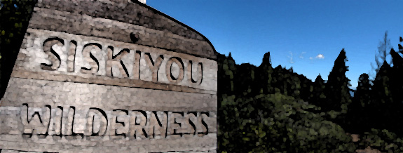
The southern Siskiyous have been visited for millenia by the Tolowa , Karuk , and Yurok. The Karuk believe that the peaks here are guardians for the headwaters of the Klamath River and that Blue Creek provides protective powers which assured a good life1. The Yurok believe that the Woge, or before time people, became afraid of human contamination and retreat to this high country where they take the form of Earthly objects. Peaks like Doctor Rock, Turtle Rock, Chimney Rock and Peak 8 are the Woge’s last refuge1. This is a region, at the high elevation crossroads of three tribes, which is held sacred by all three. I stood on a serpentine ridgeline, at the headwaters of Blue Creek, and entered the Siskiyou Wilderness as the concrete ended but the scars of an old jeep road remained.
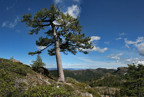
The major river valleys of the area hold a wealth of natural resources and thus allowed for densely populated Native American settlements before the arrival of Europeans. Ceremonies for ‘World Renewal’ developed out of respect for these abundant resources. It is believed that these reflective actions preserve a natural balance–to prevent catastrophe and to cure disease. To initiate these ceremonies the Indian Doctor or Medicine Makers travel into the high country for extended prayer, often for periods of 10 days of more. On mountain tops or other sacred rocks they establish tsektsels, or elegant chairs, on peaks or other prominent landmarks. From the tsektsels prayer, fasting, and dancing continue until he or she has obtained the necessary power to descend to the river country and initiate World Renewal ceremonies with others (1). Tsektsels can still be found throughout the southern Siskiyous and in fact I have come across one myself but have decided to not return to, nor reveal, that spot.
After World War II a burgeoning interest was found for the resources within the western forests, and extraction became the talk of the New Deal economic recovery. This is when a road into the southern Siskiyous was first proposed but whose manifestation came to fruition with the establishment of Redwood National Park in January of 1968. There was big timber in the Siskiyous and the Forest Service was ready to access it when the big redwoods became ‘locked up’ in the park. Construction began on a highway that would cut through and across the range from Gasquet to Orleans–it was thus named the GO Road. It was believed this route would be a boon for lumbermen and the economies of the sleepy towns it connected. By the early 1970’s all but 13 miles of the 55 mile highway had been cut, paved, and built.
“Over the years, the GO Road became much more than a conflict over natural resources. In large measure, it was a clash of two cultures–one driven by economic imperatives that demanded the landscape be altered and put to use to satisfy human material needs; the other asking that the landscape be left intact for the spiritual renewal and well-being of its inhabitants. Widely differing value systems held by Indians, environmentalists, and Forest Service personnel, more than anything else, fueled the fires of the GO Road dispute.” -Robert Dale
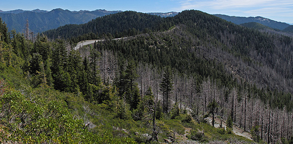
As the road was cut deeper and deeper into the wilds, environmentalist’s wilderness hackles became erect. This was a botanically diverse landscape and it needed protection from a scaring that was encroaching on not only sacred land but wild land. But the plight of the environmentalists was not going well against that of big business…
As it turned out there was a quiet faction waiting to join the fight which had been lingering in the background. The Native Americans of the area were concerned about the road but had remained quiet because in Indian circles it was unacceptable to speak directly about sacred matters. In 1974 a leading anthropologist on Yurok culture, Arnold Pilling, raised the issue of a potential violation of religious freedom guaranteed under the First Amendment of the Constitution1. He argued that the religious sites in the mountains constituted the people’s churches and asserted that “there is no question…that for any federal agency to act in such a way as to interfere with any Indian religion site is clearly unconstitutional.” This argument caught on quickly with the Indian community and more or less shut down the construction of the road1.
Battles raged in the courts and throughout communities in northwest California about the construction of the GO Road for the next 16 years. A brief summary follows:
- 1983–Judge rules Forest Service violated First Amendment
- 1984–Siskiyou Wilderness Established with provision for the road through the Chimney Rock Section where future GO Road construction would separate Blue Creek from the rest of the wilderness
- 1985-86–Court, court, and more court
- 1988–Forest Service appeals to U.S. Supreme Court. This was unprecedented because the court had never reviewed a public lands dispute concerning Indian religious freedom. The court overturned the lower court ruling in a split 5-3 decision–Indians and environmentalists were stunned. The majority opinion found “the Constitution does not provide a principle that could justify upholding [Indians] legal claim.” Justice O’Conner said “The building of a road or the harvesting of timber on publicly owned land cannot meaningfully be distinguished from the use of a Social Security number.” Justice Brennen disagreed by saying the ruling reduced the Indian’s religious freedom “to nothing more than the right to believe that their religion will be destroyed.”
- Native Americans across the country realized the decision was a major blow to their religious rights. Lawrence O’Rourke said “They might as well re-write the Constitution. They teach us we have freedom of religion and freedom of s speech, but it is not true. This was our first place, our first home. It is still our home but we do not have the same rights as other Americans.”
- Forest Service still had to address watershed impact on Blue Creek, which was a difficult hurdle.
- 1990–President Bush signs bill creating Smith River Wild and Scenic National Recreation Area into law with a provision for protecting and incorporating the uncompleted segment of the GO Road into the Siskiyou Wilderness and with that halcyon swipe of that pen the long fight was over! Ironically, this act was attached as a rider to an other wise inconsequential bill1.
Father time had taken his toll on the Forest Service’s directive to get the road built and thankfully it was never finished–but the scars will remain for hundreds of years…

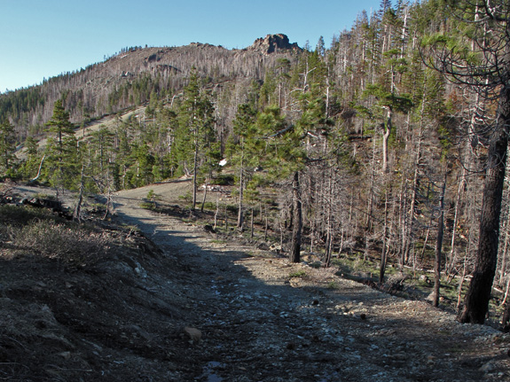
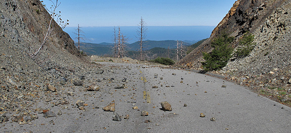

Robert Dale’s thesis provides incredible incites into the history of the region and the controversy of the GO Road’s construction. His thorough documentation explores details about the haunting history of the road–details that I pondered while walking the length of the road from above Orleans to the Smith River near Gasquet. My report here is based on that thesis which, to my knowledge, is only available at the Humboldt State Library.
Sources:
- Dale, Robert. 1992. The Gasquet to Orleans Road. Humboldt State University Masters Thesis. Arcata, California.
Download post as PDF: GO_Road_Kauffmann
COMMENT:
AUTHOR: Lauren Lester
DATE: 7/23/2010 8:22:07 PM
Interesting part of the world. I worked here many years ago- rare plant searches. I too missed getting to high mountains in spring.
—–
COMMENT:
AUTHOR: Two Crows
URL: https://www.nkdesigngroup.com
DATE: 8/3/2010 9:18:22 PM
Hello Michael– great article. Not sure if I will hike or bike this road, but it sounds intriguing in that Mad Max kind of way. Do you have a pdf of Robert Dale’s thesis cited in the article, or link to it? Would like to read more about the spiritual history of the area.
Two Crows- only place I know to find the thesis is at the Humboldt State Library. I have not been able to find it anywhere else. It is a well written document. -Michael
—–
COMMENT:
AUTHOR: Tammy
DATE: 10/3/2010 5:39:58 PM
Hi Michael, I was born in 1960 and My father (A cowboy from Colorado) took us on pack trips on our horses into the area of Dr Rock. My first trip was in 1969, I was nine years old. Did you take any more pictures of that area you can email me. I remember it being very rugged country, with beautiful views. There are quite a few trails throughout Douglas County that were made by my father on horse back.
Tammy- I have not yet been to Dr. Rock, only looked at the ridge line from a distance. The are burned extensively in 2008, but it looks like the area around Dr. Rock was spared, at least to a degree. I would like to get out there this fall. If I do I will be sure to send a picture your way. -Michael
—–
COMMENT:
AUTHOR: Ganji
DATE: 9/14/2012 2:39:10 PM
Sweet Blog! I live in Orleans and go…up the go road. Its a travesty, a crying shame that any roads go up into that country. Beatiful raw land, what they didn’t chew up.
In Sept 1958 I was 17 and a month away from entering Marine Corp Boot camp when my father, myself, a younger 14 year old brother and a 14 year old neighbor went on a back packing and fishing trip along Blue Creek. We left Flint Valley, went cross-country into the main branch of Blue Creek. We were to meet others 13 miles down in 5 days. What we didn’t realize was the main branch of Blue Creek had a Series of waterfalls and vertical wall rock canyons just above the fork of the East branch of Blue Creek. This terrain delayed our trip by 2 days that in turn triggered an air search and headlines in the Humboldt Standard Newspaper.
Now 58 years later I am planning a return trip to document with photos this area.
Do you have any photos other than those in your story?
John- I’ve heard about those waterfall but never seen them. I do have many other pictures from that area. Amazing place!
Michael: Thanks for the reply. you can email me any pictures you may have from Elk Valley down along Blue Creek and they will be appreciated. We are planning our trip in Aug this year. My son is a TV reporter and photo journalist and will take pictures to document the falls if possible. are you familiar with the 2.7 miles of dirt road between Elk Valley and the south end of the GO Road? in particular is it passable with 2WD pickups?
Michael: on 8 July 2016 my wife and I were heading toward Elk Valley to camp for a few days and investigate what had changed in the 58 years since my last trip described above. Elk Valley is about 2.5 miles from the end of the southern branch of the G.O. Road. It was raining fairly heavily and we decided to sleep in the pickup rather than drive the gravel side road since we didn’t know the road condition especially with the rain. We awoke around 11:30 when a pickup with a large propane tank passed our parking spot at the entrance to the gravel side road. It was traveling about 40mph and did not slow down are far as we could see. A few minutes later another vehicle stopped. It was a fish and game officer who was chasing the suspicious pickup. He told us marijuana growers had recently moved into private and public lands in the area and it really wasn’t safe. We left that night and never got to explore the upper portion of Blue Creek.
I camped in Elk Valley for four nights last month. Lot’s of butterflies, birds, and peace. I’m very disheartened to hear that growers have moved into the area and hope that you will be able to explore the upper portion of Blue Creek in the near future.
I helped a small group of very well known Cryptozoologists pack their scientific gear into the Siskiyou Wilderness thru Elk Valley a number of years back. I had some VERY interesting encounters/happenings involving Native American medicine men which made me a believer in ju-ju. At that time the dirt road which takes off from the paved GO road was in quite good condition and I had no problem pulling a stock trailer with mules into the picturesque large meadow setting trail head. The trails, themselves, aren’t maintained as well as other Wilderness Area trails in this area but were navigable via pack stock with a few stops which required clearing some downed logs from the trail with the small saddle saws we carried with us. My favorite part of this particular Wilderness Area is the lack of other humans in it… besides NA medicine men. It proved to be an experience I will never forget for sure ;).
Nice writeup, but writing about the religious traditions of the local Native Americans in the past tense is not accurate. These traditions are still around.
Using the past tense when talking about Native Americans is a bad habit imbued in most of us when we grew up, and it’s worthwhile to make a conscious effort to break away from this habit. These peoples and their traditions are still here today.
Language that effectively erases their continuing existence, even if countered elsewhere in the same article, is not appropriate or respectful.
Bill- Thanks for the comment, I will revise the text. Cheers, Michael
Michael, I should have stopped by quite a while ago to say thanks, and also to say that I really enjoyed the story and pictures!
Thanks for the interesting article on an area near and dear to my heart. I worked in the Lower Blue Creek area for 15 years from 1994-2009 and spent extensive time throughout the watershed. In the late 1990s a coworker and I were dropped off in Elk Valley to survey our way down the creek to the Slide Creek area (first road where we could be picked up). We had waterproof backpacks and dry suits so we could snorkel our way down the stream as feasible to survey for fish and aquatic resources. It took us four days to cover that stretch and the area near and above the East Fork confluence was extremely rugged, with several waterfalls, gorges, and steep boulder strewn reaches to traverse. I still have all my photos (slides) and field notes from that trip. I did a similar survey down the East Fork from the Lonesome Ridge Road junction to the East Fork and mainstem confluence, and another survey down Nickowitz Creek from Lonesome Ridge Road to its confluence. I also did countless surveys down the Crescent City Fork of Blue Creek over the years, which is accessed from the Gasquet side of the G-O Road. Wonderful but rugged country that few folks ever have traversed