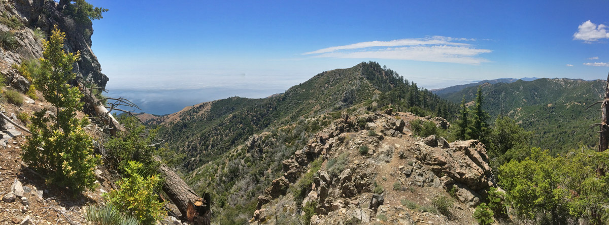
The Santa Lucia Mountains offer a magical landscape. Uplifted dramatically above the Pacific Ocean, sculpted by frequent fire return intervals throughout the Holocene, and decorated with interesting plants–the landscape tells stories reflected in deep time. Plants both evolutionarily new and old can be found across a variety of vegetation types. Steep north-facing mountainsides offer a rarity here: the absence of high-intensity fire. This happens because the steepness inhibits fuel loading in the understory. These cool microsites nurture two relict conifers–the Santa Lucia fir being one of the rarest firs in the world.
The Los Padres National Forest on the edge of the Ventana Wilderness.
I first created a map set for the trail in the winter of 2009 after hiking the trail the previous summer. It was a fun, first attempt for me to create something like this. I offered the digital map set & route description for free the past 6 years (find original map set here). During that time, hundreds of folks downloaded the file. Some of those even hiked the trail, providing me feedback on the original description. With the launch of my grand plan to establish the Bigfoot Trail Alliance, I decided it was time to revamp and update the previous document.
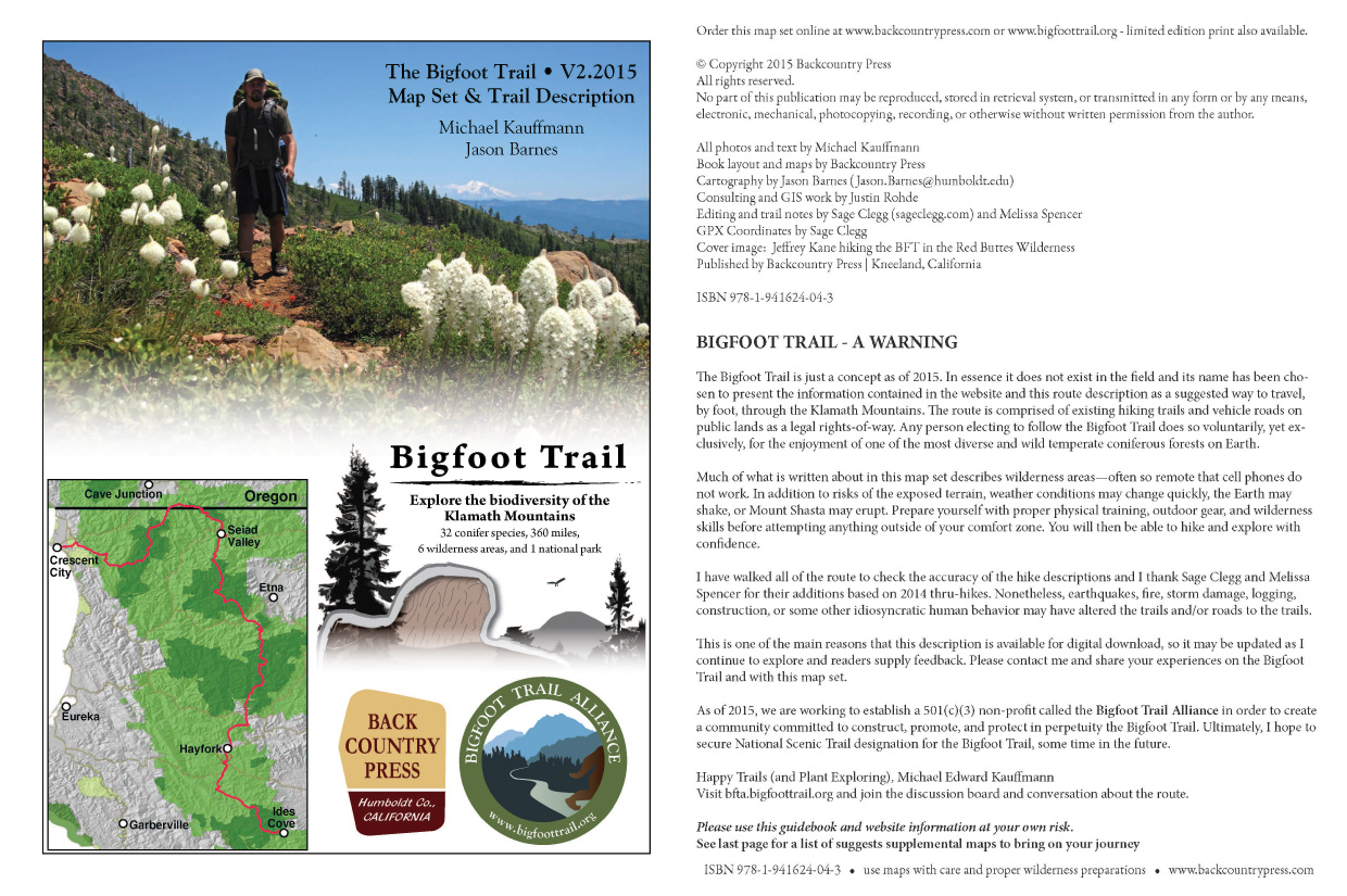
Bigfoot Trail map set V2.2015 cover pages.
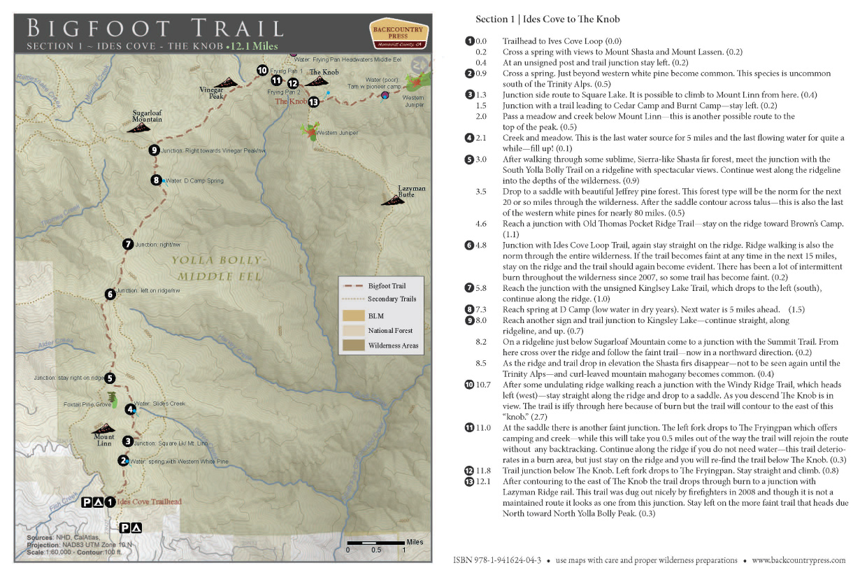
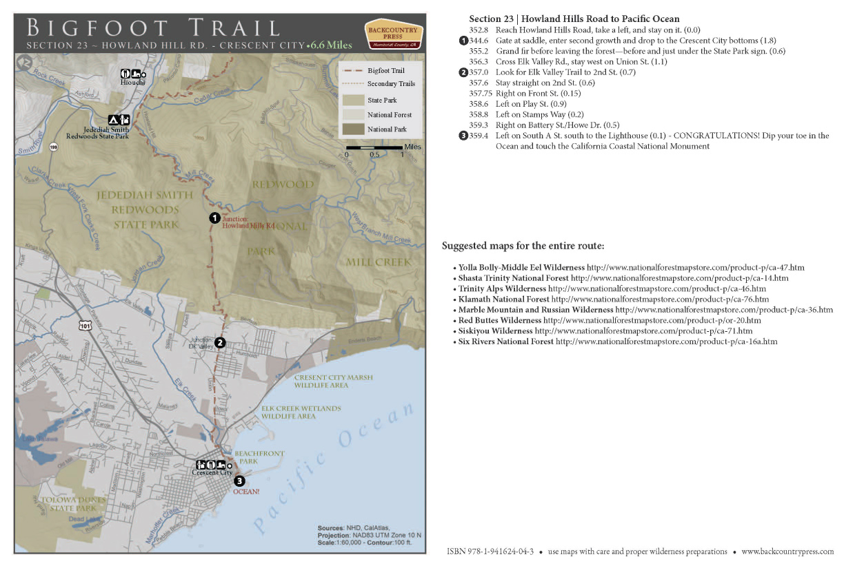
That original file got a major overhaul this spring with the help of a terrific cartographer, Jason Barnes. He and I worked out a template for the route and then created 23 brand new maps. At a scale of 1:60,000, where one inch is a mile. The description has a new, more user-friendly look and Jason’s map layers are second to none for both beauty and navigability.
Here are the details from the cover page of the new map set:
All photos and text by Michael Kauffmann Book layout and map details by Backcountry Press Cartography by Jason Barnes Consulting and GIS work by Justin Rohde Editing and trail notes by Sage Clegg and Melissa Spencer GPX Coordinates by Sage Clegg Published by Backcountry Press | Kneeland, California
ISBN 978-1-941624-04-3
Take the maps for a walk (long or short) and enjoy one of the most biodiverse temperate coniferous forest on Earth.
I’ll be sharing a Bigfoot Trail Presentation exploring the hike and the natural wonders along the way for this month’s meeting of the California Native Plant Society, North Coast Chapter. I hope you can join me!
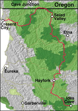
BFT Route
“The Bigfoot Trail: A Celebration of Klamath Mountain Flora.”
May 13, Wed. 7:30 p.m. At the Six Rivers Masonic Lodge, 251 Bayside Rd., Arcata.
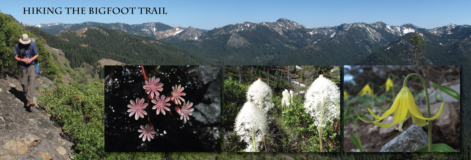
The Bigfoot Trail travels 360 miles across the Klamath Mountains from the subalpine slopes of the Yolla Bolly-Middle Eel Wilderness to the temperate rainforest in Crescent City. Michael Kauffmann, the trail’s originator, will take you on a photographic journey along the route to celebrate the region with both the common and rare plants along the way, including 32 species of conifers. Visit www.bigfoottrail.org to preview the route. To get ready for summer hiking, an updated map set and write-up for the route will be available for purchase, with a portion of the proceeds going to North Coast CNPS. Michael’s new book, A Field Guide to Manzanitas, will also be available with all proceed going to North Coast CNPS.
The Bigfoot Trail is a journey to discover the natural history of the Klamath Mountains.
Smokey Creek and South Fork Trinity River Along the Bigfoot Trail
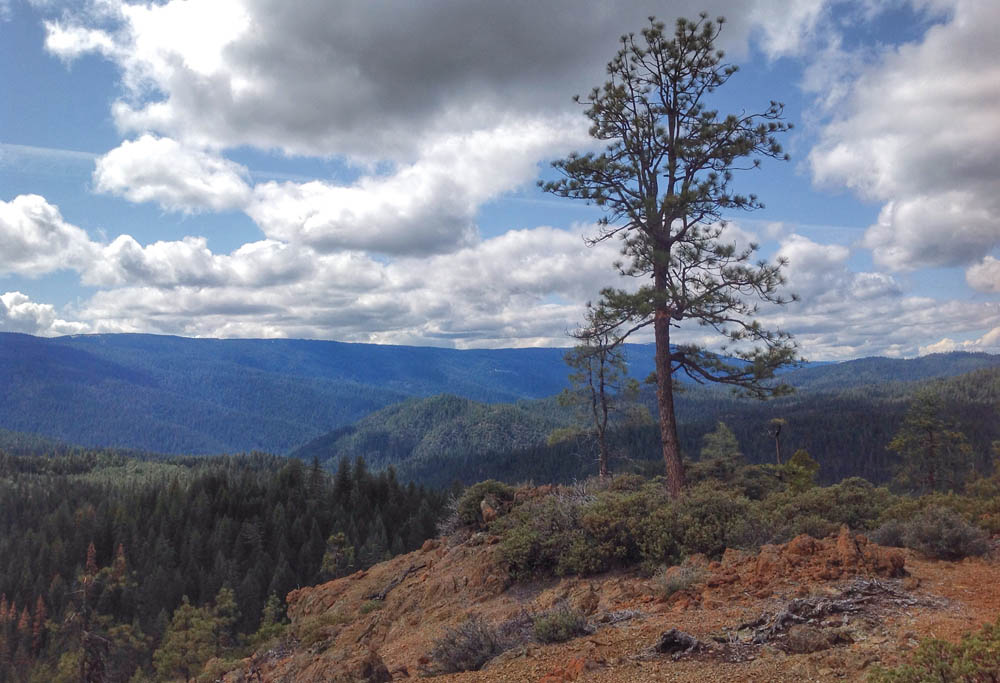
Spring break offered the opportunity for a brief trip into the southern Klamath Mountains. The Bigfoot Trail was calling, and as I am working on a new map set for the trail, my goal was to check some of the route descriptions and enjoy the wilds of Trinity County. Our first significant snowfall of the rainy season locked me out of the Yolla Bolly-Middle Eel Wilderness with over a foot above 4000′. So the lower elevations of the South Fork Trinity River became my destination. Here I would re-explore the Smokey Creek Trail and enjoy some quality time with my new friend, the manzanita.
Jeffrey pine and common manzanita (A. manzanita) on a serpentine outcrop above the South Fork Trinity River.