Rarities and Ramblings • Horse Mountain Botanical Area: Six Rivers National Forest

Original Publication DATE: 2/14/2010 3:14:00 PM

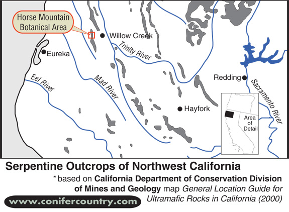
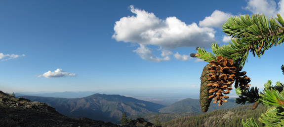
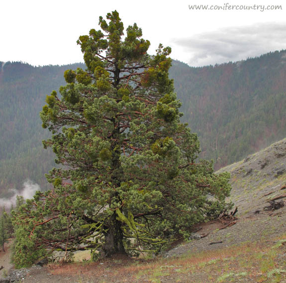
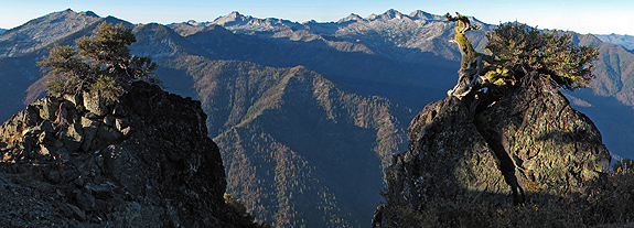
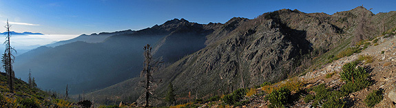
Venturing east on Highway 299 from Humboldt Bay, a stark transition–rarely noticed by travelers–occurs at Berry Summit (2900 ft). Leaving the Coast Range and entering the Klamath Mountains the landscape becomes defined by varied, complex rock types. One of these unusual rock types is known as ultramafic rock or more commonly as Serpentine. In North America, serpentine rock appears at the Earth’s surface most frequently in northwest California. The Horse Mountain Botanical Area (HMBA) is a celebration of the rock and climate that interact to create unique high elevation plant communities. In coastal northwest California, spring has arrived. Allison and I did not want winter to pass us by–we were ready for some snow play. Packing our snowshoes and lunch, we drove to the snow of the HMBA in the Klamath Mountains in less than an hour.

Above is an map of the location of the Horse Mountain Botanical Area in the Six Rivers National Forest.

Continue reading “Rarities and Ramblings • Horse Mountain Botanical Area: Six Rivers National Forest”

Foxtail Pines of Mount Linn

Original Publication DATE: 8/10/2009

Mount Linn–also called South Yolla Bolly Mountain–is the highest point in the Coast Range of northern California. It is located to the west of Corning but the area might as well be a world away from the population centers of the state; it is rarely noticed by travelers as they drive Interstate 5. Once off the interstate, scenic forest service roads still take nearly 2 hours to wind to the trailhead. Although this place has always been on my list of places to visit–the impetus for this visit was to collect some samples of the rare Sierra juniper (Juniperus grandis) for Robert Adams of Baylor University so that, through DNA testing, he might find out if these trees truly are what we think they are (see previous blog). After a 25 mile sojourn deep into the wilderness to collect those specimens it was time to search for the southern most stand of foxtail pine in northwest California–on Mount Linn.

foxtail-cone-pano
The distinct cones and “bottle-brush tassle” branches help to identify Pinus Balfouriana.

Continue reading “Foxtail Pines of Mount Linn”

Western Juniper of the Yolla Bolly-Middle Eel Wilderness

Original Publication DATE: 7/29/2009 

Two days into my 400 mile trek on the Bigfoot Trail I stopped to watch rain clouds clear above the headwaters of Cottonwood Creek–deep in the Yolla Bolly-Middle Eel Wilderness. As wind whipped the cool electric air past my ears a plant caught my eye–20 yards below the ridge on which I was balanced. This stately specimen had taken purchase many years ago in this rocky, windswept environment. This was a place in which only the heartiest of plants could hope to endure. Its reddish branches stood out in stark contrast to the lime green foliage. As I slowly crawled down the hillside my mind turned over and over with ideas of what species this might be. At first I believed it was cypress–possibly a MacNab or Sargent. But As I got closer I noticed the berry cones which are a diagnostic trait of junipers.

grandis-ridge1
western juniper (Juniperus occidentalis) on a windswept ridge.

Continue reading “Western Juniper of the Yolla Bolly-Middle Eel Wilderness”

Packers Peak – Trinity Alps Wilderness

Original Publication DATE: 9/22/2009

High above the headwaters of the Salmon River and Coffee Creek, the remarkable ascension of Packers Peak is surprising next to the seemingly superlative granite of the Alps. The peak is a pedestal on which to perch, understand, and enjoy the complex Trinity Alps Wilderness that surrounds you. It is a steep climb from Big Flat, at the end of Coffee Creek Road, to reach this vantage point; but if you are willing to climb the nearly 3,000 feet in just under 3 miles, you will be rewarded.

Atop Packers Peak
Atop Packers Peak, rock and plant fabulously frame the high Trinity Alps.

Continue reading “Packers Peak – Trinity Alps Wilderness”

Limestone Ridge ~ Trinity Alps Wilderness

Original Publication DATE: 10/12/2009 2:23:00 AM

Gaining an understanding of geology and fire ecology

I had often pondered a high and extensive ridgeline in the middle of the Trinity Alps Wilderness from other mountain top vantage points on which I stood–at one point or another–in my adventures in the Klamath Mountains. It took me several years to realize this jagged range had its own name and many years more to actually get to this isolated place. Finally, in October, I climbed my way into the high country known as Limestone Ridge. I had read this extensive ridgeline (over 3 miles long) was one of the best examples of Karst topography in western North America. This summer, the spectacular Marble Mountain was my first introduction to Karst limestone landscape in the Klamath so I assiduously pursued a chance to see more. With those distant images and arresting words burned on my brain I was finally climbing–up–up–up–from Hobo Gulch in the Trinity River Canyon.

Limestone Ridge
Climbing higher and higher, smoke lingers from this years fires while charred chaparral and montane forest remind the temporal visitor of previous year’s fires–leaving the gabbro pluton exposed, as if only just uplifted from the depths of the earth.

Continue reading “Limestone Ridge ~ Trinity Alps Wilderness”