Sugar Pines of the King Range Wilderness

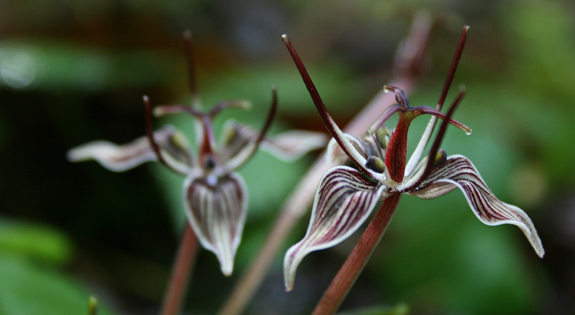
Original Publication DATE: 5/1/2011

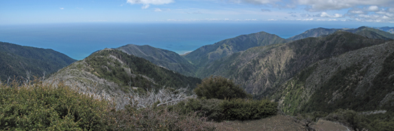
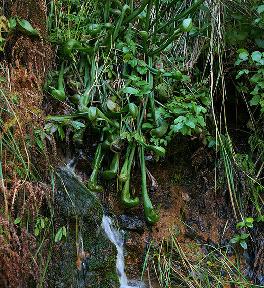
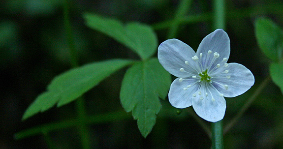
The Lost Coast presents plant associations (or lack of associates) that have long puzzled botanists. From the perspective of the conifer lover the question is: Why are redwoods, grand fir, and sitka spruce absent in an area which annually receives 100+ inches of rain, has some summer fog, and is nourished by soils from that of the central belt of the Franciscan Complex? These same conditions exist only a few mile north where redwood, grand fir, and Sitka spruce forests thrive. In the heart of this wilderness, over 20+ miles of walking, I found only two conifers. After and mentally and physically taxing journey I was left with a sense of wonder at the fortitude of the species that were present; and not the absence of the conifers unable to reside.

Untitled_Panorama11a
Panorama from King’s Peak where fire and life intertwine–where mixed-evergreen forest and coastal chaparral meet.

Continue reading “Sugar Pines of the King Range Wilderness”

Wild and Wooley

Original Publication DATE: 4/17/2011

It has been several years since my last visit to Wooley Creek. This was far too long. The Salmon River Country is magical and I was fortunate enough to find some magic this wet northern California weekend when I spent the night along one of my favorite California creeks (Check out Gambolin’ Man’s take on my other favorites). Wooley creek roared as it funneled past the trail and my camp–draining hundreds of square miles of Marble Mountain Wilderness. It would soon enter the Salmon River, briefly, before merging with the mighty Klamath River on its way to the Pacific Ocean. It felt like spring as flowers and bud were popping in the wet (and mildly warm) conditions. The mixed-evergreen forests of the Klamath Mountains are waking up.

Marble Mountain Wilderness
Entering the wild and wooley wilderness

Continue reading “Wild and Wooley”

A day at Bear Basin Butte

Original Publication DATE: 2/7/2011

During this extended period of phenomenal weather, we packed our weekend bags to rough it on the edge of the Siskiyou Wilderness. Nearly ten years ago to the day, I pursued this route to reach Clear Creek in the wilderness, a new transplant to the Klamath Region. Had I known there was a cabin en-route that I could  have rented, on the top of a mountain and in a botanical area no less, I may have never properly understood the hardships that weather in northwest California could offer the winter traveler. On that particular trip I endured snow and rain for four days, alone in Bigfoot country–meeting my first Brewer spruce, Port-Orford cedar, and Darlingtonia. I came in from the wilderness a creature void of form.

However this February 2011 weekend, surrounded by friends, it was mostly sunny with a strong chance of incredible.

Bear Basin Butte
Allison braves the cold winds to revel in a sunset over the Pacific Ocean with views to the Siskiyou Wilderness.

Myrtle Creek Botanical Area | Six Rivers National Forest

Original Publication DATE: 3/17/2010

Situated on the border of two major rock types, Myrtle Creek Botanical Area is floristically challenging as well as aesthetically arousing due to this unique geological architecture. Along the western slopes of the Myrtle Creek drainage, the North Coast Range meets the Klamath Mountains against an ancient island-arc accretion known as the Josephine Ophiolite. Plant communities are often defined by rock type, and this juncture creates unique plant assemblages. It is a place where complex rock interacts–nutrient rich soils of Coast Range meets the nutrient poor serpentines of the Josephine Ophiolite. It is also a place where ample rain falls, often in the amount of 100 inches per year. Because of these complex abiotic interactions, plants touch roots with plants in associations that almost never occur. For example, redwoods (Sequoia sempervirens) grow with pitcher plants (Darlingtonia californica) and western redcedars (Thuja plicata) with knobcone pines (Pinus attenuata).

Historically, the drainage saw major mining operations transform the landscape when placer mining (panning) in the late 1800’s gave way to the more destructive–and potentially more lucrative–hydraulic mining during the early 1900’s. Eventually, all the accessible gold was removed and as the miners left the landscape, it slowly recovered. Today, all that remains from the operations is a major sluice where the trail begins, a ditch upon which the trail is built as well as several old shafts that are fenced in for protection.

The plants have returned and, with a few exceptions, are flourishing. The wildflowers begin in mid-March and continue into early June. Orchids, trilliums, azaleas, rhododendrons, mustards, buttercups, sorrels, wood roses, huckleberry, and more create a rare botanical legacy of unique associations–ready for exploration and self-discovery. Located within the Smith River National Recreation Area, the trail has interpretive signs to aid your discoveries along the 1+ miles to the creek.
Myrtle Creek Botanical Area
Map to Myrtle Creek Botanical Area in the Six Rivers National Forest.
Pseudotrillium rivale
Brook wakerobin (Pseudotrillium rivale)
JosephineOphiolite037
Myrtle Creek
Darlingtonia californica in Del Norte County
Darlingtonia californica (by Allison Poklemba)

Pictured above is California pitcher plant (Darlingtonia californica) growing on serpentine, which is not unusual in Del Norte County. What is unusual is that along Myrtle Creek it associates with salal (Gaultheria shallon) which is in the picture and growing just above–casting shade–is a redwood tree. 

JosephineOphiolite045a
Anemone quinquefolia
Other Resources:
  1. North Coast CNPS Page for Myrtle Creek Botanical Area

—–
COMMENT:
AUTHOR: Sue
DATE: 4/24/2014 4:18:08 PM
You said: “… a ditch upon which the trail is built…” This was no ditch, but a carefully constructed Chinese Footpath – the kind a person would see in Vietnam, Cambodia, Laos, or other Asian rainforest areas. In addition to a mining camp was a Chinese labor camp. They built the footpath – which used to extend from near the falls to what is now hwy 199. I have taken several Vietnam Veterans on this trail, and they are all amazed at the similarity between this “ditch” (as you call it) and trails they saw while in Vietnam. These Chinese trails are noted by drainage area on the ‘mountain’ side of the trail, and a berm on the “creek” side of the trail. This construction helps keep the trail intact despite wet weather. Unfortunately, after over 150 years, there have been some serious mudslides along the creek that covered portions of the footpath – making it very difficult to get to the falls. There are still gold mining claims along the creek, and in the past, these mining claims have been protected with rifles. But not any more. I love this creek, have hiked it for 40 years, and treasure the botanical life. But a well-maintained trail would be nice. I would love to be able to hike to the falls again on a real trail.

Sue- Thanks for the comment. Sounds like you have a great understanding and appreciation for this wonderful creek canyon. I am sorry if I offended you by calling it a ditch, I know better now! -Michael