Klamath Mountain Peatlands

…or Fabulous Fen Photographs

This article was influenced and inspired by Gordon Leppig’s California Wetlands Fremontia.

The slow movement of water through a fen builds, over long periods of time, to the formation of peatlands. The formation of peatlands requires a combination of processes that most commonly occur in flat areas in both tropical and boreal regions. Because of variable topography, geology, and even water chemistry in the mountains, peatlands are generally rare.

In temperate mountains, rare peatlands form over mellennia if perennial soil saturation, low mineral soil deposition, erosion rates, and net storage of soil carbon resulting from plant productivity complement each other perfectly. In arctic and alpine environments, the formation of peat is often associated with peat moss (Sphagnum spp.). In the temperate regions peatlands are usually dominated and formed by sedges (Carex spp.).

Continue reading “Klamath Mountain Peatlands”
The Last Glacier in the Klamath Mountains

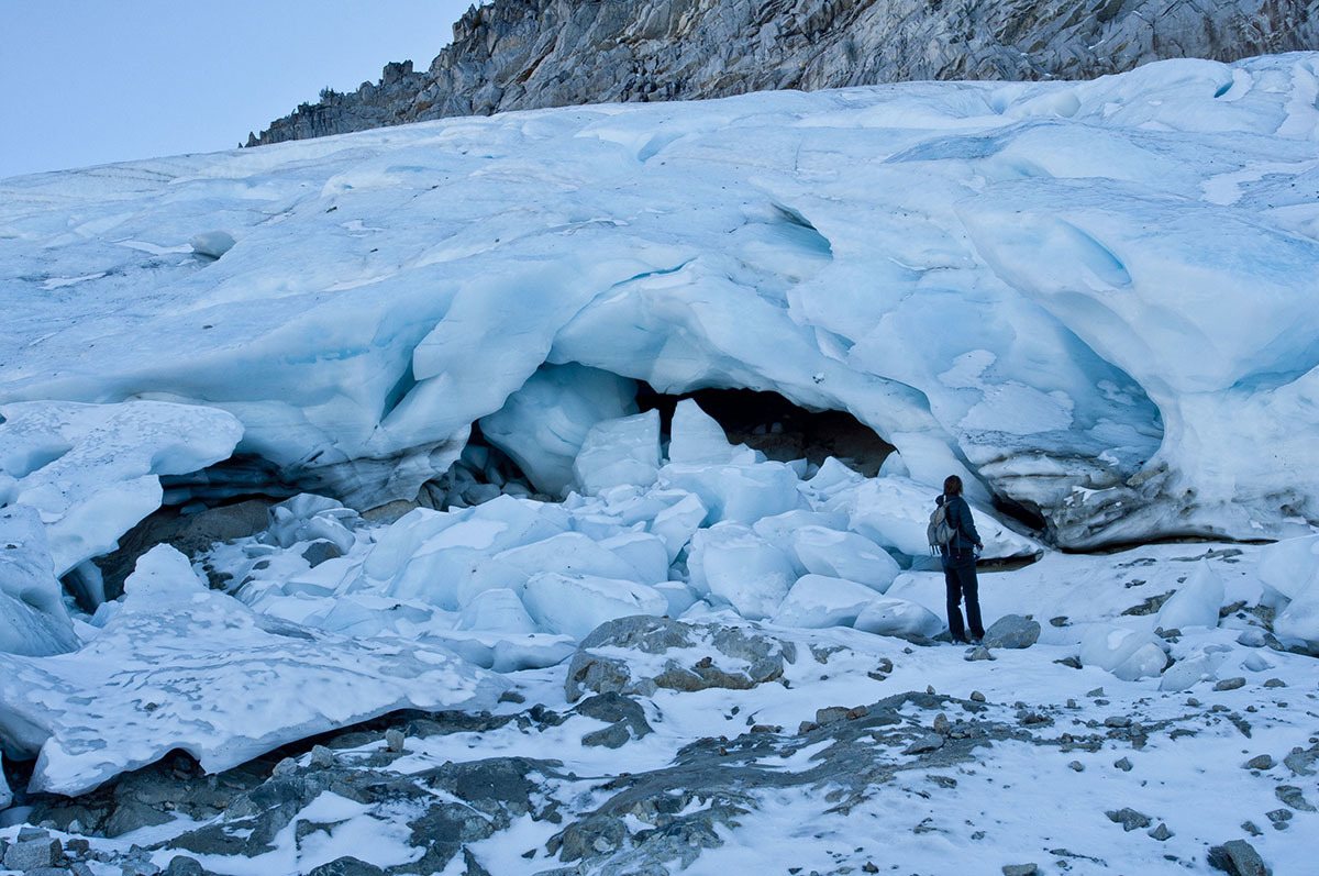
I learned about this project in 2014 and have been following it closely ever since. In late April, 2020 my friends Justin Garwood, Ken Lindke, and Mike Van Hattem (with other co-authors) published the first definitive paper on glaciers in the Klamath Mountains. While the news is bleak, their diligent research documents the changes in the Klamath for hundreds of years through the eyes of the highest peaks and watersheds in the range. Please enjoy the summary that follows.

Justin M. GarwoodAndrew G. FountainKenneth T. LindkeMichael G. van Hattem, and Hassan J. Basagic “20th Century Retreat and Recent Drought Accelerated Extinction of Mountain Glaciers and Perennial Snowfields in the Trinity Alps, California,” Northwest Science 94(1), 44-61, (22 April 2020). https://doi.org/10.3955/046.094.0104


Continue reading “The Last Glacier in the Klamath Mountains”

Castle Crags State Park

Geologic History

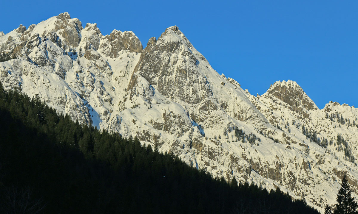
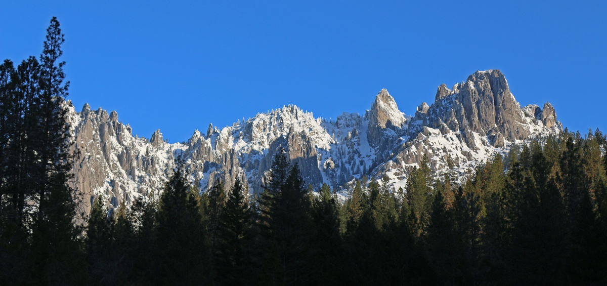
Castle Crags State Park is within the Klamath Mountains geomorphic province. The eastern Klamath Mountains are built from the oldest rock in the range with the newest to the west. This is due to the continued accretions of oceanic crust added on to the western edge of North American continent. Rocks surrounding Castle Crags are mostly of the Ordovician-aged (443–490 million year old) Trinity ultramafic sheet.

Castle Crags State Park
The dramatic granite of Castle Crags State Park is the result of a plutonic intrusion that is 160 million years old..

Continue reading “Castle Crags State Park”

Marine Terraces of California

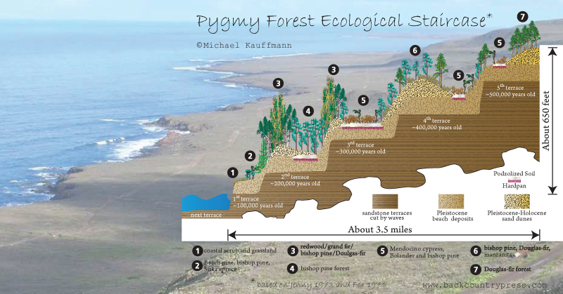
In 2012 I first visited the marine terraces of coastal Mendocino County and was captivated by what I learned. The blog and graphic I cooked up after that visit has been one of the more popular entries on this website. In fact, the United States Geological Survey recently published a document on the Marine Terraces of California that features:

  • How marine terraces form
  • Soils sequences of California’s terraces
  • Where to find marine terraces of California
  • The main graphic from my blog about Mendocino’s ecological staircases

Marine Terraces of California

Find the document here:

Schulz, M., Lawrence, C., Muhs, D., Prentice, C., and Flanagan, S., 2018, Landscapes from the waves—Marine terraces of California: U.S. Geological Survey Fact Sheet 2018–3002, 4 p.

Middle Tennessee Cedar Glades

Map adapted from William J. Wolfe, “Hydrology and Tree-Distribution Patterns of Karst Wetlands at Arnold engineering Development Center,” USGS

Edaphic islands have long-fascinated me–especially having grown to understand the serpentine barrens of the Klamath Mountains. So when we found ourselves visiting the Central Basin Region of middle Tennessee I discovered, through the help of the Tennessee Native Plant Society, that this area is botanically special for its limestone prairies, often called glades. While numerous state designated natural areas were recommended, I chose to learn about the Middle Tennessee Cedar Glades at Flat Rock Glades and Barrens State Natural Area.

Continue reading “Middle Tennessee Cedar Glades”

Serpentines of the Salmon Creek-Mattole River Divide

Original Publication DATE: 1/19/2013

On the divide between the South Fork of the Eel River and Mattole River exists a place I had repeatedly mapped while creating the images for for Conifer Country. I knew there was a small patch of serpentine in this isolated location because of the occurrence of two tree species that are uncommmon on the North Coast outside of the Klamath Mountains proper. In the past I had asked regional ecologists about this location and the common response was “its is somewhere out near the Mattole River.” I knew that already, but how could I find the exact location?

The mystery was solved when Kyle and Dana Keegan, offered a “visit to the Salmon Creek watershed which is a tributary of the South Fork Eel. We have an especially unique diversity of plants and trees here due to a complex melange of geologic features with what we believe to be the largest, most westerly stand of Jeffrey Pine in the state, as well as vast stands of Incense Cedar. Kinda like an isolated westerly chunk of the Klamath Siskiyous–with it comes a whole host of serpentine endemics.”

Yes please…

UntitledPanorama38
Kyle and Dana Keegan looking across the headwaters of the Mattole River.

Continue reading “Serpentines of the Salmon Creek-Mattole River Divide”

Frenzel Creek Research Natural Area

Original Publication DATE: 5/26/2011

The first journey of the summer has begun and as I make my way south to the Sierra San Pedro Martir botanically diverse destinations will craft the route I drive. The first stop was not too far from home, but a place I had not yet been. The serpentine soils along the Frenzel Creek Research Natural Area foster the sympatric overlap of two cypresses–along with many other unique serpentine plants. Enjoy the photo-blog, as I won’t have a lot of time to write with many miles to travel.

Frenzel Creek RNA
MacNab cypress grow in a shrubby form in the uplands growing with leather oak among other species.

Continue reading “Frenzel Creek Research Natural Area”

Rarities and Ramblings • Horse Mountain Botanical Area: Six Rivers National Forest

Original Publication DATE: 2/14/2010 3:14:00 PM

Venturing east on Highway 299 from Humboldt Bay, a stark transition–rarely noticed by travelers–occurs at Berry Summit (2900 ft). Leaving the Coast Range and entering the Klamath Mountains the landscape becomes defined by varied, complex rock types. One of these unusual rock types is known as ultramafic rock or more commonly as Serpentine. In North America, serpentine rock appears at the Earth’s surface most frequently in northwest California. The Horse Mountain Botanical Area (HMBA) is a celebration of the rock and climate that interact to create unique high elevation plant communities. In coastal northwest California, spring has arrived. Allison and I did not want winter to pass us by–we were ready for some snow play. Packing our snowshoes and lunch, we drove to the snow of the HMBA in the Klamath Mountains in less than an hour.

Above is an map of the location of the Horse Mountain Botanical Area in the Six Rivers National Forest.

Continue reading “Rarities and Ramblings • Horse Mountain Botanical Area: Six Rivers National Forest”

Limestone Ridge ~ Trinity Alps Wilderness

Original Publication DATE: 10/12/2009 2:23:00 AM

Gaining an understanding of geology and fire ecology

I had often pondered a high and extensive ridgeline in the middle of the Trinity Alps Wilderness from other mountain top vantage points on which I stood–at one point or another–in my adventures in the Klamath Mountains. It took me several years to realize this jagged range had its own name and many years more to actually get to this isolated place. Finally, in October, I climbed my way into the high country known as Limestone Ridge. I had read this extensive ridgeline (over 3 miles long) was one of the best examples of Karst topography in western North America. This summer, the spectacular Marble Mountain was my first introduction to Karst limestone landscape in the Klamath so I assiduously pursued a chance to see more. With those distant images and arresting words burned on my brain I was finally climbing–up–up–up–from Hobo Gulch in the Trinity River Canyon.

Limestone Ridge
Climbing higher and higher, smoke lingers from this years fires while charred chaparral and montane forest remind the temporal visitor of previous year’s fires–leaving the gabbro pluton exposed, as if only just uplifted from the depths of the earth.

Continue reading “Limestone Ridge ~ Trinity Alps Wilderness”